Trexler Nature Preserve


Park Overview:
Established as a game preserve, bison, elk and white-tail deer still roam its pastoral fields and mountainsides. Hikers can select short, easy trails or a challenging perimeter trail of 8.5 miles with spectular views.
Park Description:
More than a hundred years ago General Harry C. Trexler purchased numerous small farms creating a game preserve to help protect American bison and elk from extinction. In the 1930s the property was bequeathed to Lehigh County and in 2004 the game preserve became the Trexler Nature Preserve. The grounds were opened to the public to enjoy the animals in their natural habitat. Its three ranges -- North, South, and Central -- feature unique landscapes from meadows and hills to hemlock forests and deep ravines. The Jordon Creek flows through each of the ranges, while passing under two covered bridges.
In contrast to freely roaming herds, a zoo is situated in the Preserve’s Central Range. Also in the same Range is the Trexler Environment Center, Leigh County’s first "Leadership in Energy and Environmental Design" (LEED) certified building.
Be aware that archery hunting is permitted on the North Range according to PA Game Commission rules and regulations and during the appropriate hunting seasons. Call the Commission 610- 871-1444 for more information or their Southeast Regional office at 610-926-3136.
Use the Web Map on this site to view a trail map. Informative, printed brochures in full color with a trail map are available on the kiosks at the parking areas at the Trexler Environmental Center, at the parking area of the Lehigh Valley Zoo, at the Zoo overlook and at the parking area of the North Range off Mill Creek Rd.
Trails Overview:
The Preserve has 20 miles of trails. Of the 13 blazed trails, all but one are 2 miles or less, are “easy” or “moderate” in difficulty and in the North or Central Ranges. There are plenty of opportunities to combine the trails into various loop hikes.
The “Covered Bridge Trail” (double red triangles) is ADA accessible, with a hard surface over its 1.2 miles. A parking area is located on Old Packhouse Road where it crosses Geiger’s Covered Bridge. (Note: several double-colored blazed trails exist in the Preserve, they are displayed on the map with a black line down the middle of the pathway.)
The “Observation Trail” is an 0.3 mile loop around the Environmental Center (double teal blaze).
The most challenging is Trexler Border Trail (red blaze) at 8.5 miles which goes around the periphery of the Preserve. This multi-use (bikes, horses, hiking) border loop includes one stream crossing, several very steep hills, long switch backs, and open fields, where buffalo, elk and deer animals can be seen off in the distance. This is the only trail in the Preserve with a difficulty rating of “Hard.”
Click to find a detailed description of a hike in the park.
Park Acreage:
1108.00 acresMunicipality:
SchnecksvilleEstablished as a game preserve, bison, elk and white-tail deer still roam its pastoral fields and mountainsides. Hikers can select short, easy trails or a challenging perimeter trail of 8.5 miles with spectular views.
More than a hundred years ago General Harry C. Trexler purchased numerous small farms creating a game preserve to help protect American bison and elk from extinction. In the 1930s the property was bequeathed to Lehigh County and in 2004 the game preserve became the Trexler Nature Preserve. The grounds were opened to the public to enjoy the animals in their natural habitat. Its three ranges...
Park Acreage:
1108.00 acresMunicipality:
SchnecksvilleContact Information
Web Link:
Trexler Nature Preserve, County of Lehigh Park SystemPhone:
(610) 871-1444Fees:
NoneDogs in park:
Dogs on leash
Hike Checklist:
Whether you are going for a day hike or backpacking overnight, it is good practice to carry what we call The Hiking Essentials. These essentials will help you enjoy your outing more and will provide basic safety gear if needed. There may also be more essentials, depending on the season and your needs.
The Essentials
Hiking Shoes or Boots
Water - Two quarts per person is recommended in every season. Keep in mind that fluid loss is heightened in winter as well as summer. Don't put yourself in the position of having to end your hike early because you have run out of water.
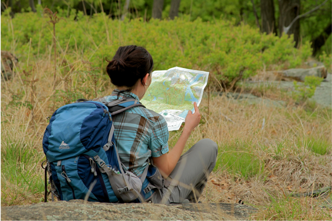
Map - Know where you are and where you are going. Many of our hiking areas feature interconnecting network of trails. Use a waterproof/tear-resistant Tyvek Trail Conference map if available or enclose your map in a Ziplock plastic bag. If you have a mobile device, download Avenza’s free PDF Maps app and grab some GPS-enhanced Trail Conference maps (a backup Tyvek or paper version of the map is good to have just in case your batteries die or you don't have service). Check out some map-reading basics here.
Food - Snacks/lunch will keep you going as you burn energy walking or climbing. Nuts, seeds, and chocolate are favorites on the trail.
Sunscreen and insect repellent
Rain Gear and Extra Clothing - Rain happens. So does cold. Be prepared for changing weather. Avoid cotton--it traps water against your skin and is slow to dry. If you are wearing wet cotton and must return to your starting point, you risk getting chills that may lead to a dangerous hypothermia. Choose synthetic shirts, sweaters and/or vests and dress in layers for easy on and off.
Compass - A simple compass is all you need to orient you and your map to magnetic north.
Light - A flashlight or small, lightweight headlamp will be welcome gear if you find yourself still on the trail when darkness falls. Check the batteries before you start out and have extras in your pack.
First Aid Kit - Keep it simple, compact, and weatherproof. Know how to use the basic components.
Firestarter and Matches - In an emergency, you may need to keep yourself or someone else warm until help arrives. A firestarter (this could be as simple as leftover birthday candles that are kept inside a waterproof container) and matches (again, make sure to keep them in a waterproof container) could save a life.
Knife or Multi-tool - You may need to cut a piece of moleskin to put over a blister, repair a piece of broken equipment, or solve some other unexpected problem.
Emergency Numbers - Know the emergency numbers for the area you're going to and realize that in many locations--especially mountainous ones, your phone will not get reception.
Common Sense - Pay attention to your environment, your energy, and the condition of your companions. Has the weather turned rainy? Is daylight fading? Did you drink all your water? Did your companion fail to bring rain gear? Are you getting tired? Keep in mind that until you turn around you are (typically) only half-way to completing your hike--you must still get back to where you started from! (Exceptions are loop hikes.)
Check the weather forecast before you head out. Know the rules and regulations of the area.
The Leave No Trace Seven Principles
Plan Ahead and Prepare
- Know the regulations and special concerns for the area you'll visit.
- Prepare for extreme weather, hazards, and emergencies.
- Schedule your trip to avoid times of high use.
- Visit in small groups when possible. Consider splitting larger groups into smaller groups.
- Repackage food to minimize waste.
- Use a map and compass to eliminate the use of marking paint, rock cairns or flagging.
Travel and Camp on Durable Surfaces
- Durable surfaces include established trails and campsites, rock, gravel, dry grasses or snow.
- Protect riparian areas by camping at least 200 feet from lakes and streams.
- Good campsites are found, not made. Altering a site is not necessary.
- In popular areas:
- Concentrate use on existing trails and campsites.
- Walk single file in the middle of the trail, even when wet or muddy.
- Keep campsites small. Focus activity in areas where vegetation is absent.
- In pristine areas:
- Disperse use to prevent the creation of campsites and trails.
- Avoid places where impacts are just beginning.
- Pack it in, pack it out. Inspect your campsite and rest areas for trash or spilled foods. Pack out all trash, leftover food and litter.
- Deposit solid human waste in catholes dug 6 to 8 inches deep, at least 200 feet from water, camp and trails. Cover and disguise the cathole when finished.
- Pack out toilet paper and hygiene products.
- To wash yourself or your dishes, carry water 200 feet away from streams or lakes and use small amounts of biodegradable soap. Scatter strained dishwater.
- Preserve the past: examine, but do not touch cultural or historic structures and artifacts.
- Leave rocks, plants and other natural objects as you find them.
- Avoid introducing or transporting non-native species.
- Do not build structures, furniture, or dig trenches.
- Campfires can cause lasting impacts to the backcountry. Use a lightweight stove for cooking and enjoy a candle lantern for light.
- Where fires are permitted, use established fire rings, fire pans, or mound fires.
- Keep fires small. Only use sticks from the ground that can be broken by hand.
- Burn all wood and coals to ash, put out campfires completely, then scatter cool ashes.
- Observe wildlife from a distance. Do not follow or approach them.
- Never feed animals. Feeding wildlife damages their health, alters natural behaviors, and exposes them to predators and other dangers.
- Protect wildlife and your food by storing rations and trash securely.
- Control pets at all times, or leave them at home.
- Avoid wildlife during sensitive times: mating, nesting, raising young, or winter.
Be Considerate of Other Visitors
- Respect other visitors and protect the quality of their experience.
- Be courteous. Yield to other users on the trail.
- Step to the downhill side of the trail when encountering pack stock.
- Take breaks and camp away from trails and other visitors.
- Let nature's sounds prevail. Avoid loud voices and noises.
The Trail Conference is a 2015 Leave No Trace partner.
(c) Leave No Trace Center for Outdoor Ethics: www.LNT.org.
Directions to Trailhead :
From the I-78 West Delaware River toll bridge entering Pennsylvania, drive 22 miles then take exit 53 for Route 309 North. Follow Route 309 North for 6.5 miles then turn left on Old Packhouse Road at the traffic light with Rita’s, Wayback Burgers and Sam’s Bagels in a strip mall on the right. Follow Old Packhouse Road for 0.9 mile then turn right on Orchard Road. The Nature Preserve entrance will be 0.3 mile ahead on the left near the Trexler Environmental Center (Street address: 4935 Orchard Rd., Schnecksville, Pa., 18078.)
Trexler Nature Preserve Observation Deck Parking Lot, Orchard Rd, Schnecksville, PA 18078 – GPS Coordinates: 40.655319, -75.614716
There are more than a half-dozen parking areas in the Preserve. Stop in at the Environmental Center to pick up a user brochure with trail map that also locates these other areas.
 Support the trails with a donation!